
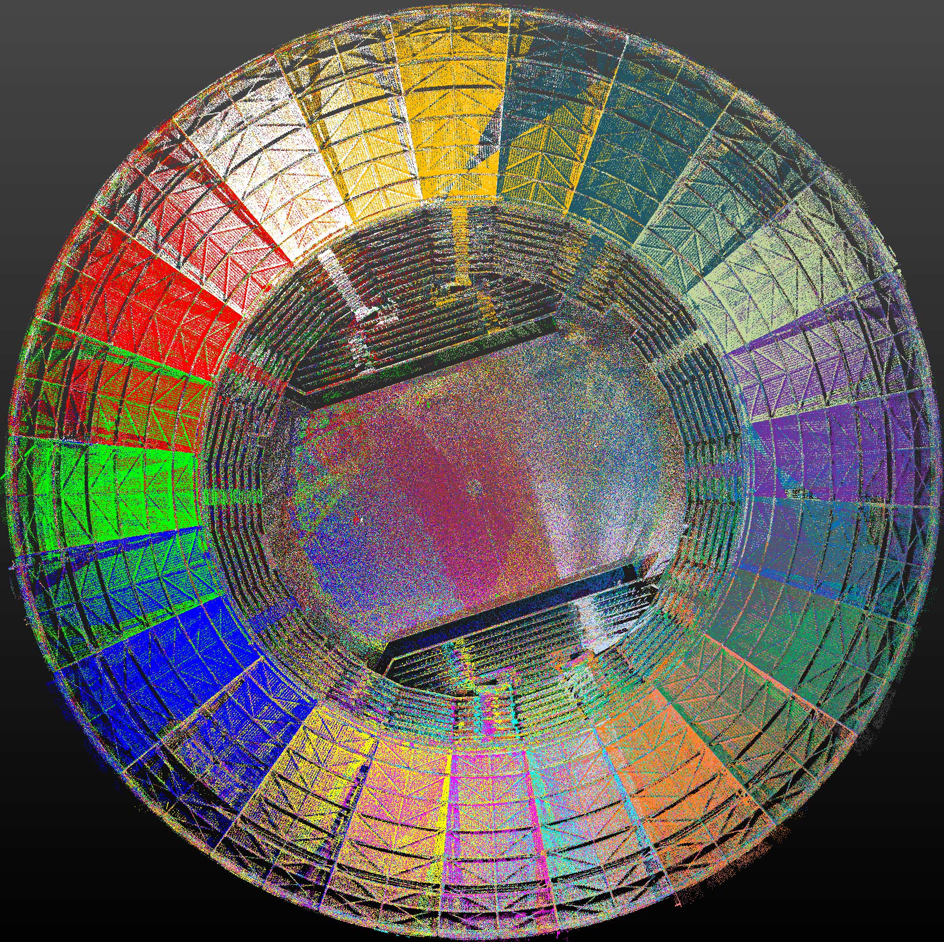
We scan Monuments and Heritage Buildings with the help of a Terrestrial Laser Scanner with high geodetic accuracy up to 2mm.
The scanner captures millions of points, which are georeferenced and combined with photography done with the latest state-of-the-art equipment. They are processed using specialized software programs on powerful computer systems.
Modeling
Regardless of the complexity of the Monument, we produce “as is” models at a scale of 1:1 (“As Is” Mesh Models)
The models have the high fidelity photographic texture of the actual space or object.
Virtual tours of sites
Interactive site tour in the model where the study team, the monument administration or an online browser can share rich visual material. It is possible to measure in three dimensions on the site. Decisions are made immediately.
Remote users will feel like they are there, making their experience easier without travel costs.
Applications in Construction for the Installation of New Systems
• Quick and accurate measurement of interior and exterior surfaces, “as-is”
• Complex renderings of interiors and details
• 3D model creation 3D model export – 2D Drawings
• Modelling of indoor and outdoor spaces in combination
• Documentation drawings “As is” “As is”
• B.I.M. (Building Information Modeling) Connection of 3D drawings with the Monument database
• Member mapping and distortion control
• Visual Inspection: Monitor the Project jointly with remote partners. Explore the facility remotely and check all the linked information for each part of the facility.


