
With the high precision imprinting work we perform, we produce construction drawings so that each individual new construction or prefabrication is linked to the existing structure with millimeter-level accuracy.
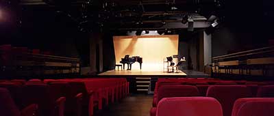
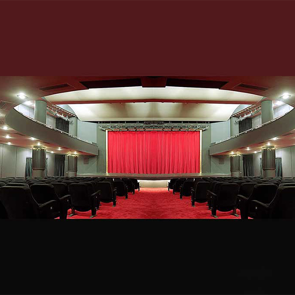
How is the Mapping of Movie Theatres & Concert Venues done?
The mapping of existing buildings both externally and internally is done by Precision Topographic Measurements combined with the use of a Static Laser Scanner where all architectural, structural, mechanical and other details are captured.
Each of the buildings is captured with a digital scanner and photographed.
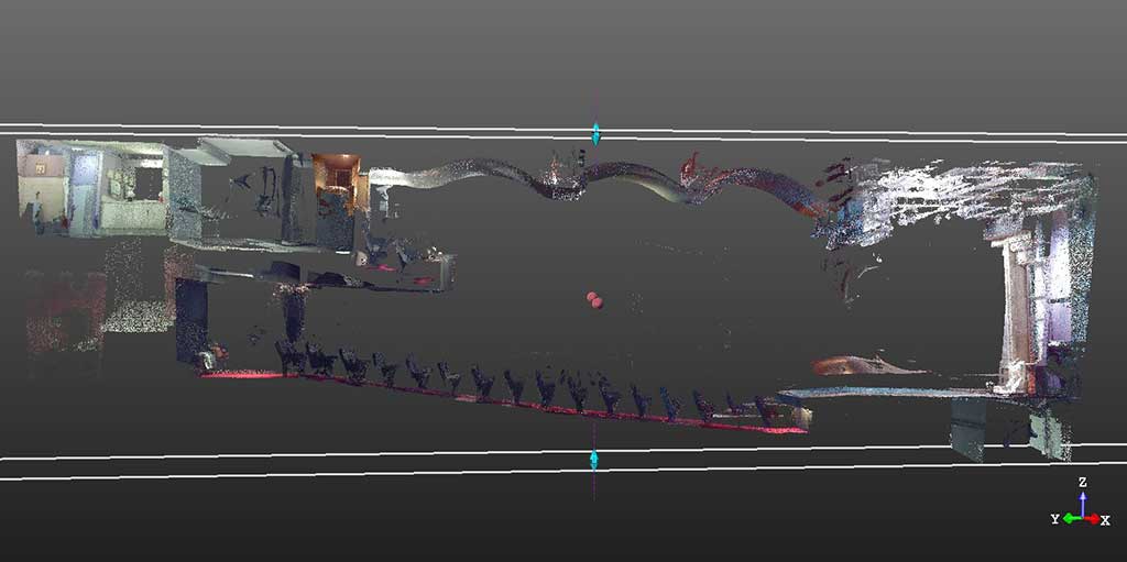
SPATIAL SCANNING
LASER SCANNING & PHOTOGRAPHY
We scan your spaces using a Terrestrial Laser Scanner spatial scanner with industrial geodesy accuracy up to 2mm.
The scanner captures millions of points, which are georeferenced and combined with photography done with the latest state-of-the-art equipment. They are processed using specialized software programmers on powerful computer systems
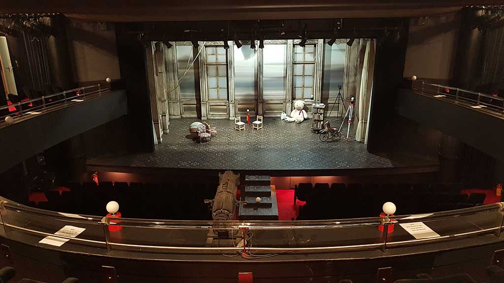
VIRTUAL TOUR OF SITES
Interactive site tour where the design team, the project management or a potential client can share rich visual material. It is possible to measure in three dimensions in space. Decisions are made immediately.
Remote users will feel like they are there, making their work easier with less travel costs.
VIEW & VOLUME MODELING
Regardless of the complexity of the facilities we produce “just as they are” at 1:1 scale (As built models).
In the case of monuments and ancient theatres, models are created that can have the photographic texture of the actual space or object.
What are the final deliverables?
After processing the above material, a 3D model of the site is produced, from this a complete set of two-dimensional documentation drawings of the building is created:
- Floor Plans, Elevations, Elevations, Horizontal and Vertical Sections (2D CAD Drawings)
- Orthophotographs of the floor plans
- Orthophotographs of the elevations
- Orthophotographs of Views Opened photographic views of monuments – buildings
- 3D Models / 3D Model of the Building
- Photographic Texture in the 3D Model
- 3D BIM Smart Models (Read more)
- Orthophotos – Expansions of every surface of the building whatever its shape
- Create Virtual Tour application and edit for usability by Trimble Real Works Viewer virtual reality glasses
- Color Point Cloud Point Cloud
- Topographic renderings that combine the above with the building’s surroundings and accompany the building permit
- Profiling – ability to select cross-sections
- 3D virtual tour of the model with VR Glasses


