Heritage Inventory
Spatial scanning laser scanning and photography
The scanner captures millions of points, which are georeferenced and combined with photography done with the latest state-of-the-art equipment. They are processed using specialized software programs on powerful computer systems.
Rescue of the original monument
Creation of a Faithful Copy of the Monument to ensure its uniqueness for future generations.
In case of any damage – natural or other destruction, the possibility of immediate restoration of the original is given since every detail of the Monument and the surrounding area will be recorded.
MODELING
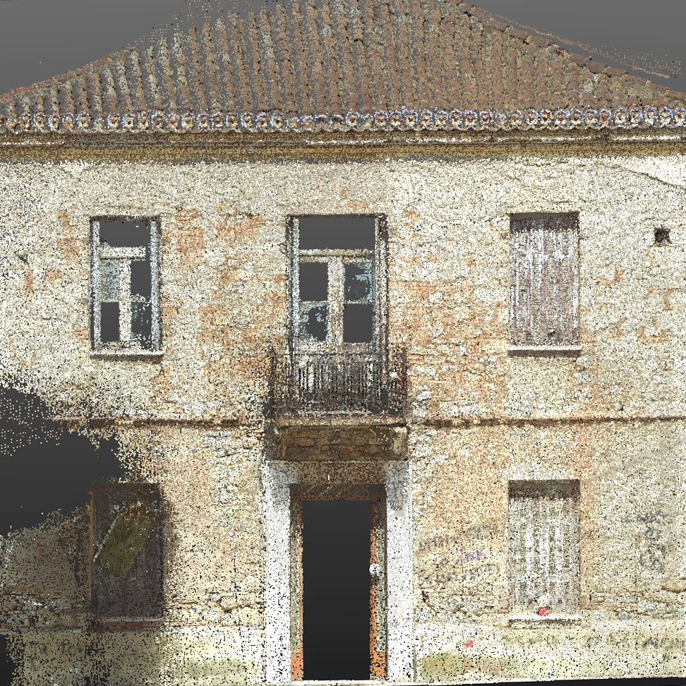
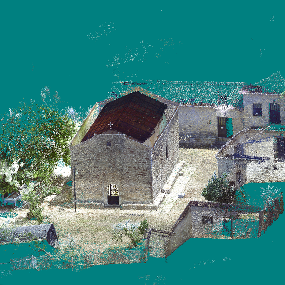
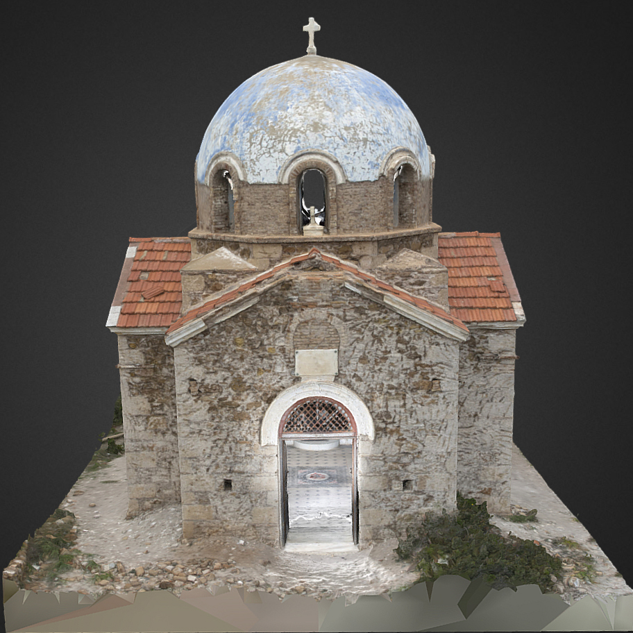
Regardless of the complexity of the Monument we produce “as is” in 1:1 scale (“As Is” Mesh Models)
The models have the high fidelity photographic texture of the actual space or object.
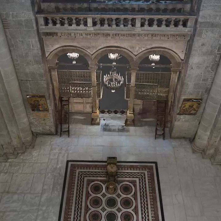
Virtual tours of sites
Remote users will feel like they are actually there, making their experience easier without travel costs.
Applications in Damage Restoration – Construction of New Sections
- Quick and accurate measurement of interior and exterior surfaces, “as-is”
- Complex impressions of interiors and details
- 3D model creation 3D model export – 2D drawings
- Modelling of indoor and outdoor spaces in combination
- Documentation drawings “as is” “As is”
- B.I.M. (Building Information Modeling) Connection of 3D drawings with the Monument database
- Member mapping and distortion control
Archaeological sites
The plan depicts the entire field, for each trench, and illustrates sections of the trench. The usual mapping scales are 1:50 or 1:20.
The plans are georeferenced and the excavation canvas is shown on them.
Compilation of Orthoimages
All the color tones and textures of the materials and every detail present in the spaces at the time of Scanning and Photography are accurately rendered.
The Existing Condition Orthoimages contain all the information in which the condition of the building is captured and rendered metrically and can be accurately reproduced (drawn).


Conatact us!
It is advisable to have someone with you who knows the property boundaries. It will be useful to have with you old topographic maps and anything related to the property (contracts, building permit plans, expropriation plans, classification deeds, cadastral maps, etc.). In case of a large area, wear comfortable clothes and shoes because we will need to walk the property’s contour to find its boundaries.
