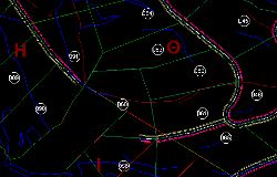
EGSA 87
In any topographic that is compiled it is necessary to depend on this network. Both for the diagrams that are necessary for the forest office and the characterization acts, as well as for the town planning for the issuance of a permit (according to the recent Law 4030 FEK 249 / 25-11-2011, it is a condition to report a list of coordinates in the EGSA system ‘. 87. Also, the diagrams that accompany the contracts of sale and other legal transactions, but also the diagrams that are drawn up for the arrangement of arbitrary constructions depend on the same network.
In all general topographic diagrams drawn up for installation of Photovoltaic systems , for the definition of Aegialos lines and Beach , for Private Urban Planning it is necessary to depend on the EGSA ’87 system.
By compiling a recent topographic diagram in EGSA ’87 we ensure:
- Check the existing status with that of the securities.
- Confidence in the submission of the application and completion of the process of the
- Land Registry or the declaration of the arbitrators.
- Avoid unnecessary expenses from future court disputes in case of vague or incorrect topographic diagrams.
- Compilation of a topographic diagram in a single grid of coordinates (EGSA ’87) for absolute control – identification with the National Land Registry.
The old method of connecting topographic works to the national grid of coordinates was triangulation. The connection was made either by front or back by the trigonometric points of the G.Y.S. Now the connection is made with geodetic receivers of satellite positioning, ie GPS.
XYZ are the three dimensions of space.
Specifically are the coordinates of each point in a coordinate system. Each country also has a coordinate system so that both services can communicate better with each other, and each can easily locate everything in a common system. Thus, every map, every design, every information, can be placed in space and used by more than one. Such information can range from purely technical issues such as land use, building conditions, location of properties to very common ones such as weather, information about shops, museums or whatever.
At XYZ we specialize in the three dimensions and every work we deliver refers to the national network of EGSA ’87 coordinates. Apart from the topographic diagrams and orthophoto maps that we produce, but also the dependencies that we make, they refer to the same network.
For any information do not hesitate to contact us. We will be happy to assist you!

Contact Us!
It would be good to have someone together who knows the boundaries of ownership. It will be useful to have old topographic diagrams and anything related to the property with you (contracts, building permit plans, expropriation plans, characterization deeds, cadastral diagrams, etc.). In case it is a large area, wear comfortable clothes and shoes because we will need to walk on its contour to find its limits.